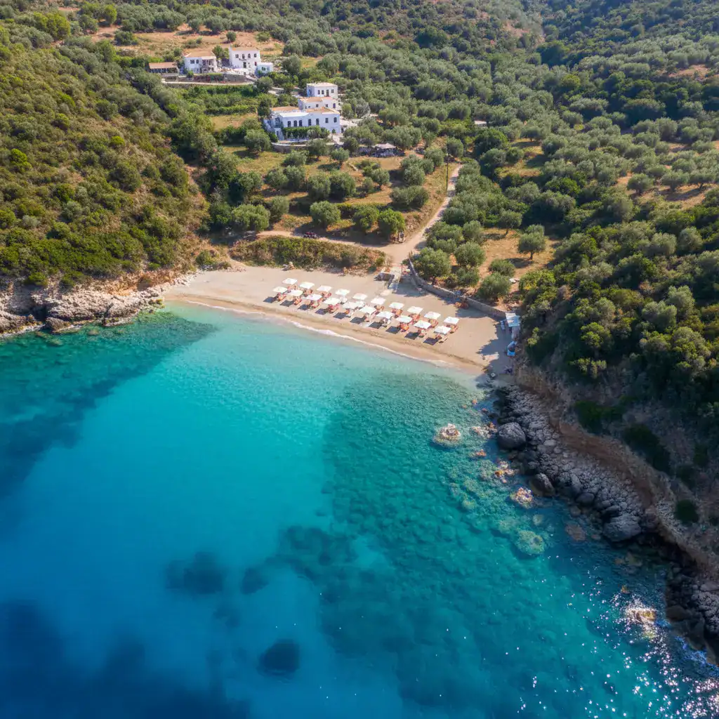
Corfu Land Registry Grants Beach Access Days After ‘Untouched Beach’ Ban
In a chronological sequence that leaves no room for misinterpretation, the Corfu Land Registry, a service under the jurisdiction of the Ministry of National Economy and Finance, signed two concession agreements for beach use at Halikounas, Corfu, on April 27, 2026. This happened despite the area being declared an “Untouched Beach” just three days earlier, on April 24, 2026.
The Timeline of Encroachment
On April 24, 2026, the Ministries of National Economy and Finance and Environment and Energy jointly announced a ministerial decision to expand the list of “Untouched Beaches” from 238 to 250, aiming for strict biodiversity protection. The official “appendix-untouched” explicitly lists on line 191 the KORISSION LAGOON (CORFU) – GR2230002. According to the new Joint Ministerial Decision (JMD), these beaches prohibit the concession of simple use rights for the seashore and beach, as well as any activity that endangers the morphology and ecological function of the ecosystem.
The relevant entry in the official Appendix I of the Joint Ministerial Decision for the 250 “Untouched Beaches” (April 24, 2026) clearly identifies the Korission Lagoon of Corfu, Natura 2000 code GR2230002, South Corfu Municipality. Just three days later, the Land Registry granted concessions within these very coordinates.
The Agreements in Question
Three days after the JMD, the Head of the Corfu Land Registry proceeded to sign the following contracts:
- Contract ΨΜ4ΗΗ-Ρ0Σ (Protocol No. 39637 APA 2026): Concession of 499.92 sq.m. for umbrellas and sunbeds at “Halikounas 3” (KERK 64). The granted section KERK64, with coordinates (X=145856.69, Y=4374221.62), falls within the protected zone GR2230002.
- Contract ΡΩ9ΝΗ-ΗΑΒ (Protocol No. 39622 APA 2026): Concession of 15 sq.m. for a canteen at “Halikounas 5” (KERK 76). The granted section KERK76, with coordinates (X=145916.23, Y=4374194.15), also falls within the same protected zone GR2230002.
Both contracts were signed on April 27, 2026.
The Data Speaks for Itself
A comparison of the coordinates leaves no doubt. The coordinates of the conceded sections, for KERK 64 (e.g., point 0: X=145856.69, Y=4374221.62), fall entirely within the boundaries of the protected Natura 2000 area “Korission Lagoon,” as defined on line 191 of the appendix (X range: 147007 to 144875, Y: 4373368 to 4374864). The same applies to KERK 76, with coordinates X=145916.23, Y=4374194.15. The conceded sections are located exclusively within the mapped core of the area.
Blunder or Premeditated Action?
The announcement of the new JMD was made on April 24. Three days later, on April 27, the Corfu Land Registry routinely signed the contracts. Without hesitation, without control, without any reference to the new decision that the Ministry of Finance itself had just co-signed. The question is not only how the signatures occurred, but why the competent services of the Ministries themselves did not ensure that the land registries were informed of the decision they had just co-signed. And today, May 6, ten days after the signing, the contracts remain in force. No revocation, no explanation.
Questions Demanding Answers
Voice News publicly addresses the following questions to the relevant ministers:
- To the Minister of National Economy & Finance, Mr. Kyriakos Pierrakakis: How did a service under your jurisdiction allow the signing of concession agreements in an area that the state legislated as absolutely protected three days earlier? Will it be investigated whether there was a procedural failure or a conscious circumvention of the new JMD? And, most importantly: will these contracts be immediately revoked?
- To the Minister of Environment & Energy, Mr. Stavros Papastavrou: What is the value of your signature on the “Untouched Beaches” when another state service, under the umbrella of the same state, commercially leases them out and conspicuously ignores the new JMD? What measures are you taking to ensure that line 191 of the protective appendix will be respected in practice?
The two Ministries must provide explanations. The mapping of a beach as “untouched” is not a symbolic gesture; it is a legal commitment with immediate effect. And these contracts, based on the data posted on Diavgeia, have been concluded in violation of this commitment.