Greece Redefines Seismic Zones: Ionian Islands in Highest Risk Category
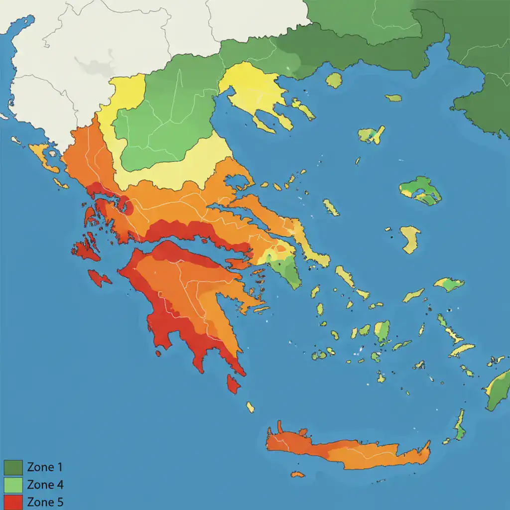
Corfu, April 26 – Greece has introduced a new seismic hazard map, expanding the country’s seismic zones from three to five. This reclassification places the Ionian Islands, the Corinthian Gulf, and the Western Peloponnese into Zone 5, indicating a significantly higher seismic risk. The proposal, led by Professor Kyriazis Pitilakis, has been submitted to OASP and ELOT, aligning with the revised European Eurocode 8 (EC8) regulations.
Key Changes in the New Seismic Map
The primary change is the division of the country into five seismic zones, an increase from the previous three. This updated classification reflects a more precise understanding of seismic activity across Greece. Notably, the Ionian Islands, the Corinthian Gulf, and the Western Peloponnese are now designated as Zone 5, the highest risk category.
Impact on Building Design and Safety
The new map introduces more stringent specifications aimed at safeguarding human lives and preventing structural collapses. The most significant changes include:
- Elimination of Exclusive PGA Use: Building design will no longer solely rely on peak ground acceleration (PGA). Instead, it will incorporate two spectral acceleration values that more accurately describe seismic behavior.
- New Soil Coefficients: The introduction of ground amplification coefficients that depend on soil type and earthquake intensity.
- Existing Structures: The new parameters apply to both the design of new buildings and the assessment of older structures, which constitute 80-90% of Greece’s building stock.
Economic Implications and Safety Benefits
According to the AUTH study, implementing these new measures is estimated to increase the total cost of repairs for the entire country to 108 billion euros, an increase of 20 billion euros compared to the current regulations. However, the study emphasizes that with the new map, 80% of residential buildings would sustain insignificant to minor damage in the event of a design earthquake. This highlights a significant improvement in safety and resilience despite the increased costs.
This reclassification underscores Greece’s commitment to enhancing seismic safety and protecting its citizens and infrastructure, particularly in regions prone to high seismic activity like the Ionian Islands.
Source: startmediacorfu.gr